
In a country like the Philippines, where seismic activity is a constant reality, earthquake instruments are more than just scientific tools—they’re essential for protecting lives, infrastructure, and economies. As technology continues to advance, so does our ability to anticipate, measure, and respond to seismic events with greater precision and speed. But what exactly do these instruments do, and how are they shaping the way we manage earthquake risk?
Let’s explore how modern seismic tools are transforming risk management and helping communities become more resilient.
1. Real-Time Earthquake Monitoring
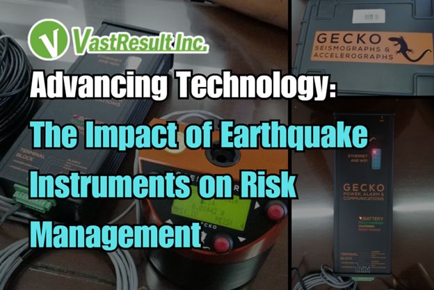
Modern earthquake instruments, such as seismometers and accelerographs, provide real-time monitoring of seismic events. These devices detect and record ground movements with remarkable accuracy, allowing agencies like PHIVOLCS to issue quick alerts and impact assessments.
Impact on Risk Management:
Faster warnings reduce reaction time during emergencies.
First responders can make informed decisions using live data.
Real-time updates improve public awareness and preparedness.
2. Improved Structural Safety with Strong-Motion Data
Strong-motion accelerographs, now common in urban areas and critical facilities, record how structures behave during an earthquake. Engineers use this data to design and retrofit buildings that are better equipped to withstand seismic forces.
Impact on Risk Management:
Structural vulnerabilities can be identified and corrected.
New buildings are designed based on actual motion data.
Minimizes loss of life and property during major quakes.
3. Strategic Urban and Infrastructure Planning
Earthquake instruments also support geohazard mapping and ground shaking analysis, which inform land-use planning and infrastructure development. Areas prone to liquefaction or landslides can be identified early.
Impact on Risk Management:
Helps planners avoid high-risk zones.
Infrastructure like bridges, highways, and dams can be built with seismic considerations.
Supports safer development and disaster-resilient cities.
4. Integration with Emergency and Public Warning Systems
As seismic instruments evolve, they are being integrated into broader disaster response systems, including public alert systems and early warning networks. Some models can automatically shut down gas lines or halt transportation services in case of a strong earthquake.
Impact on Risk Management:
Prevents secondary disasters like fires or explosions.
Reduces chaos and accelerates response time.
Boosts community trust in disaster management systems.
5. Data for Policy and Insurance
The vast amount of seismic data collected over time is used to shape government policies, update building codes, and create more accurate insurance risk models. This helps both public and private sectors better prepare for future events.
Impact on Risk Management:
Informs smarter policies and regulations.
Promotes accountability and safety compliance.
Encourages preparedness through incentives like lower premiums.
Why Earthquake Instruments Matter for Risk Management
1. They Turn Uncertainty into Actionable Information
Seismic tools like seismometers and accelerographs detect and measure ground motion as it happens. This real-time information helps agencies like PHIVOLCS quickly locate the epicenter, assess intensity, and determine which areas are most at risk—allowing them to respond with speed and precision. This is critical because in emergency situations, even a few seconds’ warning can make the difference between chaos and control.
2. They Make Buildings Safer Before Earthquakes Happen
By capturing how structures react to seismic activity, instruments provide engineers with real data to improve building designs or upgrade existing infrastructure. This proactive approach means communities aren’t just hoping their buildings will hold—they’re built with proven data in mind, minimizing casualties and reducing costly damage when earthquakes hit.
3. They Help Build Smarter, Safer Cities
Earthquake instruments support geohazard mapping and ground shaking analysis, which guide urban development and land use planning. Knowing where faults, landslide-prone slopes, or liquefaction zones are located allows planners to avoid building in high-risk areas. This helps ensure critical infrastructure—like bridges, hospitals, and schools—is placed where it’s less likely to be severely impacted by a quake.
4. They Power Early Warnings and Emergency Actions
Modern seismic systems are now integrated into public warning systems that can automatically send alerts, shut off gas lines, or halt trains in the event of a strong quake. These smart responses reduce the chances of secondary disasters, like fires or accidents, and give people just enough time to take cover.
5. They Shape Better Policies and Insurance Standards
The historical and real-time data collected from these instruments is used to update building codes, inform disaster policies, and build more accurate insurance models. This data-driven approach promotes stronger regulations and more informed decisions—while also helping communities recover more quickly and efficiently after a disaster.
Final Thoughts
Technology is revolutionizing the way we prepare for and respond to earthquakes. Through accurate measurement, real-time communication, and proactive planning, earthquake instruments have become a cornerstone of effective risk management in the Philippines and beyond.
Stay Prepared with VastResult
At VastResult, we support organizations and local governments in implementing advanced seismic monitoring systems that meet both regulatory and safety requirements. Whether you’re managing a building, a city, or an entire region, we’re here to help you build a stronger, safer future.
Contact us at (02) 0804 0740 or email us at sales@vastresult.com to inquire today to learn more about our seismic solutions and how they can benefit your risk management strategy.